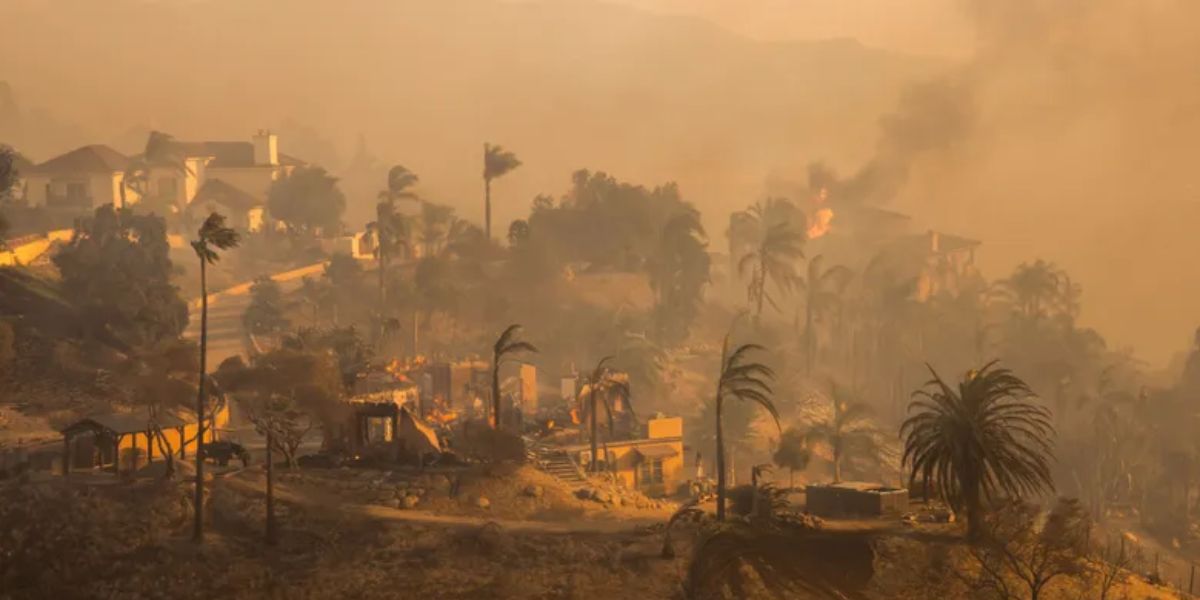
The bulk of Los Angeles and Ventura counties in Southern California are at the “highest possible” risk of fire due to Santa Ana winds, according to the Los Angeles National Weather Service office.
It is predicted that such winds would increase on Monday night and last until Wednesday night.
Through Tuesday, a “Particularly Dangerous Situation” (PDS) Fire Weather Warning has been issued by the NWS for a large portion of Ventura and Los Angeles counties’ Santa Ana wind corridor. The Susana Mountains are under a PDS Warning till Wednesday. A Fire Weather Warning is also in effect for San Diego County, which is further south.
These fire weather conditions might “rival other historical fires in recent times,” such as the Thomas Fire in December 2017 and the Mountain Fire last month, according to forecasters with the Los Angeles NWS office.
In early November, the Ventura County Mountain Fire destroyed around 250 homes and buildings as it rapidly spread to roughly 20,000 acres.
The Santa Ana Mountains in Southern California are the source of the Santa Ana winds, which carry hot, dry air from east of the mountains. Although they can happen at any time of year, they are more often in the fall and winter when temperatures are lower.
Damaged wind gusts might result in power outages and the downing of trees and powerlines along many of these counties’ windier routes.
Through social media, San Diego Gas & Electric warned consumers that, in order to prevent any fires caused by downed powerlines, the utility company may turn off power based on wind conditions.
People in the alert regions should be prepared to evacuate at any time, according to CAL Fire Public Information Officer Mike Cornett, who spoke to local media.
Forecasters anticipate that this week will see Santa Ana winds, which frequently raise the risk of fire in Southern California.
“This event has the potential to be as strong as the November 5th-6th Santa Ana event that led to the Mountain Fire,” cautioned the National Weather Service in Los Angeles. “Make sure you have a defensible space and prepare an evacuation strategy in case of fire conditions. Any new fire will spread quickly and probably behave like an extreme fire.
The period from late Monday evening to Wednesday will present the worst risk of fire. On Tuesday, “extreme” fire weather conditions are predicted by NOAA’s Storm Prediction Center for locations along the Southern California coast, including Santa Clarita, Thousand Oaks, Simi Valley, Moorpark, and Santa Paula.
The Los Angeles Fire Department (LAFD) is advising people not to use spark-creating equipment outside this week due to the expected circumstances.
“If you must, ensure you have adequate water on hand to extinguish any sparks before it’s too late,” LAFD said to Facebook.
Winter Storm to Affect 2,000 Miles, Snow in the Northeast and Flooding in the South
With strong gusts and choppy seas, this wind direction may also produce dangerous conditions at Avalon Harbor.
On Tuesday, the mountains might see wind gusts of up to 70 mph and a relative humidity of 5% to 10%.
By Wednesday afternoon, the winds will be less strong. The humidity will be very low, though.


 by
by 


