 by
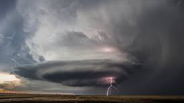
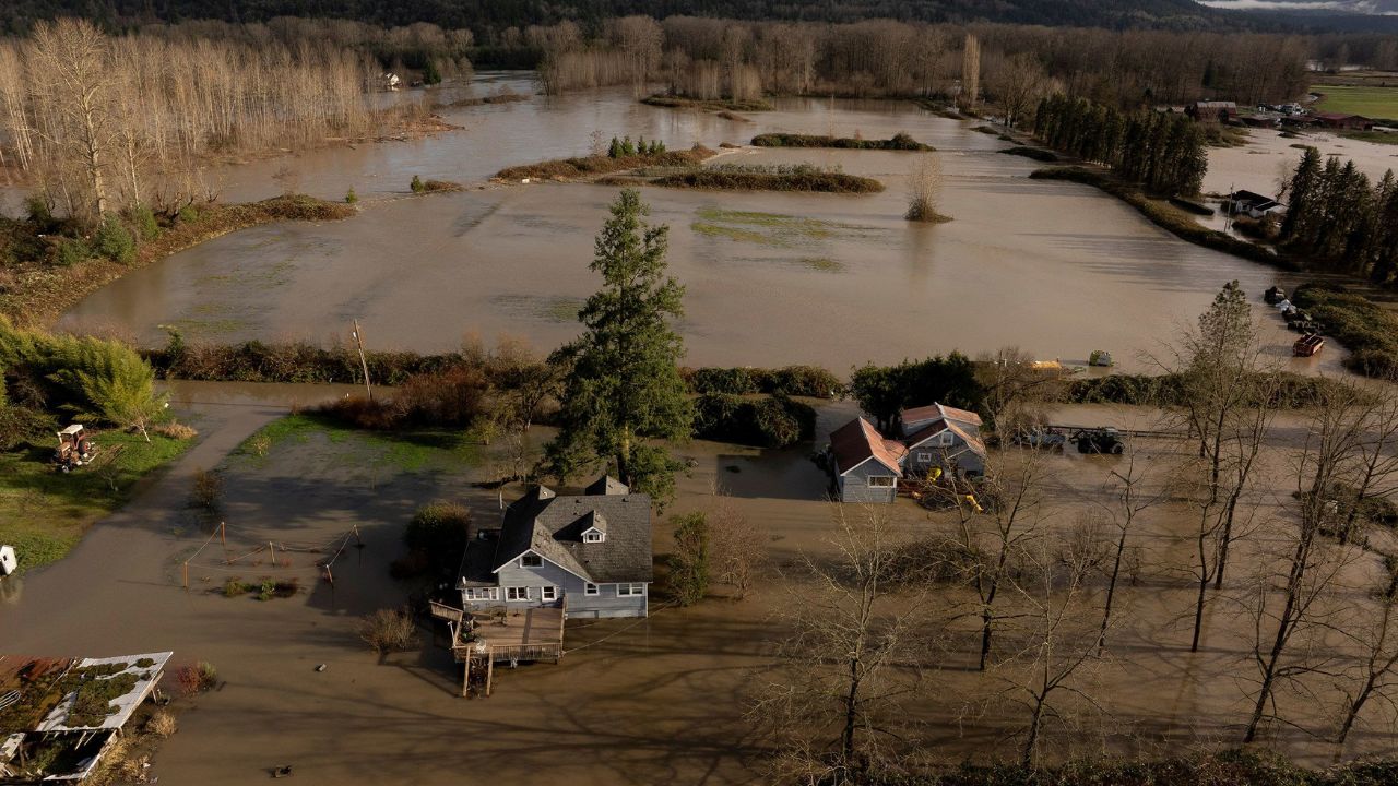
by Seattle, WA – Days of intense rain fueled by a series of atmospheric rivers have inundated communities across the Pacific Northwest, flooding farmland, homes, and major roadways. Several areas have already recorded up to a foot of rain, and meteorologists warn that the threat is far from over.
Videos circulating online show rivers spilling over their banks, swallowing cars and leaving neighborhoods submerged. In Seattle, emergency crews carried out multiple water rescues after vehicles hydroplaned or became stranded in rapidly rising floodwaters. Officials say that conditions may worsen as additional storm systems develop.
Communities Face Mandatory Evacuations
Residents of Orting, Washington, were ordered to evacuate early Wednesday afternoon as water levels along the Puyallup River surged. Local officials described the situation as rapidly evolving, with the town at high risk due to nearby river gauges nearing or exceeding historical records.

Washington Gov. Bob Ferguson announced on X that the State Emergency Operations Center had escalated to Level 1 activation, the highest alert status.
“Our state emergency management personnel remain ready to support our local communities if they request help, and the Washington National Guard has resources ready if necessary,” he stated.
Schools across western Washington and northwestern Oregon implemented closures or delays as flooding made travel unsafe, according to the Associated Press.
Record-Breaking Rainfall Across the Region
During a brief pause in the heaviest downpours Tuesday evening, the full scale of the storm’s impact became more apparent. A rain gauge at Swift Creek, Washington, registered 13.2 inches, while June Lake reported 10.4 inches. In Oregon, North Fork recorded 9.4 inches over the same period.

Daily rain records were shattered across multiple cities including Portland, Salem, Pendleton, Hermiston in Oregon, and Ellensburg, Quillayute, Hoquiam, and Olympia in Washington.
Meteorologists at AccuWeather emphasize that this sequence of storms stems from persistent atmospheric rivers drawing deep moisture from the Pacific Ocean, creating continuous cycles of heavy precipitation.
River Gauges Break or Approach Historic Highs
According to the National Weather Service, several rivers in the region have either already broken records or are expected to in the coming days.
Key river impacts include:
- Puyallup River near Orting, WA – tied its all-time record early Wednesday morning
- Grays River near Rosburg, WA – set a new record at 33.36 feet, surpassing the previous high from December 2007
- Skagit River near Mount Vernon, WA – projected to exceed its record by 4.14 feet
- Snohomish River at Monroe, WA – forecast to rise 4.62 feet above its historic peak
- Skagit River near Concrete, WA – expected to climb 5.06 feet beyond previous records
Officials warn that downstream flooding is highly likely as these rivers continue to rise and additional rain falls over the watershed.

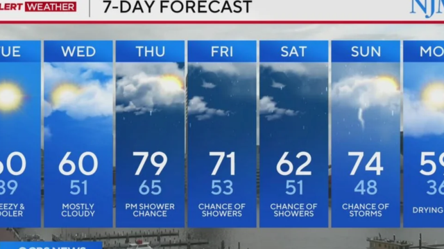
More Storms on the Way
While the Pacific Northwest may experience a brief lull or northward shift in rainfall late this week, AccuWeather meteorologists caution that the storm track will shift southward again. Larger systems are expected to arrive over the weekend, bringing another round of heavy rain into early next week.
Emergency managers urge residents to remain vigilant, especially those living near rivers, streams, and low-lying areas prone to flash flooding.
Staying Safe in Ongoing Flood Conditions
Authorities advise residents to avoid driving through flooded roads, monitor official weather updates, and prepare evacuation plans if they live near vulnerable waterways. Rapid changes in water levels and poor visibility can create life-threatening hazards.
Communities across the region continue to brace for additional storms, hoping that emergency measures and early warnings will help minimize further damage.
If you live in the affected areas, share your experience or current conditions in the comments below.