 by
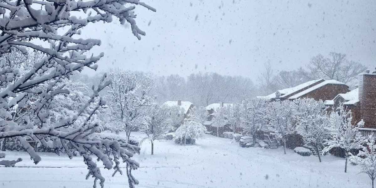
by New York City, NY — Seven states across the Northeast and Mid-Atlantic are preparing for a second winter storm just days after the first storm caused heavy snowfall and widespread school closures. The initial storm, which struck Tuesday, dropped as much as 12 inches of snow in parts of the region, snarling traffic and disrupting daily life.
Meteorologists warn that lingering effects from Tuesday’s storm will continue through Wednesday morning, with residual snow and icy conditions remaining on roads. Authorities are urging residents to exercise caution, particularly on untreated surfaces, as travel remains hazardous.
Expected Snowfall for the Upcoming Storm
By Thursday night, a “quick-hitting storm” is forecasted to impact many of the same states, including Virginia, West Virginia, Maryland, Delaware, Pennsylvania, New Jersey, and New York. While the new storm is not expected to be as severe as Tuesday’s system, AccuWeather senior meteorologist Alan Reppert says areas that receive snow may see 3 inches or less in most locations.

The National Weather Service (NWS) reported that the first storm produced moderate to heavy snow across interior New England, with 5 to 10 inches expected from central New England to Downeast Maine, and isolated totals up to 12 inches. The storm developed as a rapidly intensifying low-pressure system off the Mid-Atlantic, drawing Atlantic moisture along a sharp coastal front.
Potential Ice and Rain Threats
While snow is anticipated in northern states, forecasters are also cautioning about ice and rain impacting southern areas. Portions of Virginia, eastern Tennessee, and North Carolina could see a dangerous mix, creating slick roads and challenging travel conditions. The interaction between the cold air and the storm’s southern reach will determine the exact distribution of snow, ice, and rain.
AccuWeather Chief On-Air Meteorologist Bernie Rayno notes that if cold air moves too aggressively into the Northeast, the storm could move out to sea, producing mainly rain in the Southeast, with only a narrow zone of snow or ice along the northern edge.
Travel Impacts in Major Cities
Although the chances of a major snowstorm remain low, the storm could still disrupt key travel hubs, including Washington, D.C., Philadelphia, New York City, and Boston. Airports, highways, and rail systems may experience delays if snow and ice accumulate during the storm’s peak.

Authorities are advising travelers to monitor local weather updates, allow extra time for commuting, and prepare for potential disruptions over the coming days. Residents should also ensure emergency kits, warm clothing, and snow removal equipment are ready in case conditions worsen.
Winter Weather Advisories Still in Effect
Several winter weather advisories and storm warnings remain in effect across Ohio, Pennsylvania, West Virginia, and up through Maine, though many of these alerts are set to expire Tuesday night or Wednesday morning, depending on the location. Officials emphasize that even after the first storm, roads and sidewalks may remain slippery, particularly on untreated surfaces.
Are you preparing for another winter storm so soon after the last one? Share your thoughts in the comments — how are you handling the snow and icy conditions?