 by
by Chicago, IL – A powerful winter system is moving across the Midwest and Great Lakes region, bringing heavy snowfall, dangerous winds, and widespread blizzard conditions that could shut down travel for millions of residents. Forecasters warn that some areas may see snow totals climbing into double digits as the storm strengthens through midweek.
Widespread Snow and Blizzard Conditions Expected Across the Midwest and Great Lakes
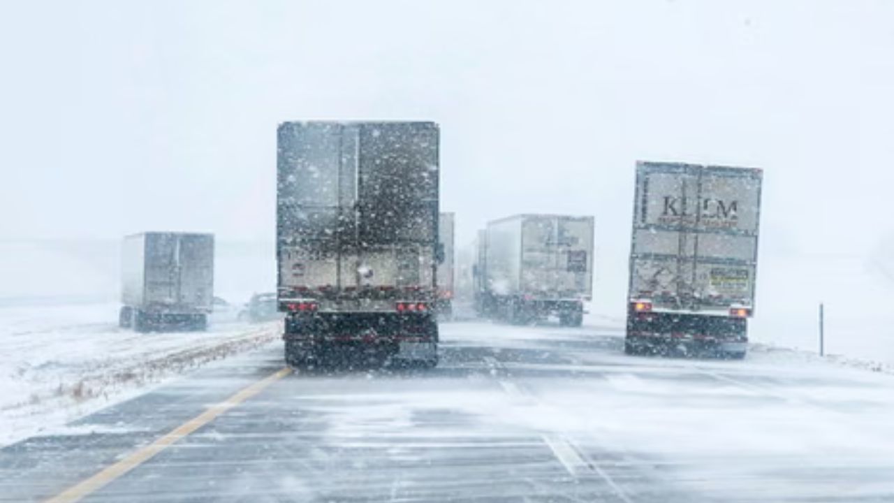
Much of the region is still recovering from a recent arctic blast, and now another fast-moving “clipper” system is set to intensify conditions. According to the Weather Channel, the incoming system will deliver up to 12 inches of snow, along with blizzard-level winds.
In a statement, forecasters emphasized the severity of this setup:

“The next clipper will bring snow, ice and wind to the Midwest and Great Lakes Tuesday, shifting east and impacting the Northeast Wednesday. A swath of 3–5 inches looks likely for many with some locations seeing up to a foot of snow. On top of that, wind gusts in excess of 60 mph will be possible, leading to blizzard conditions and power outages in the bitter cold.”
Meteorologists say whiteout visibility and drifting snow are likely, especially in rural and open areas, where high winds can quickly turn roadways hazardous.
Buffalo Expected to See Some of the Heaviest Snowfall
Communities near Lake Erie are preparing for a disruptive midweek storm. Buffalo, NY, one of the region’s frequent snow hotspots, is expected to be especially impacted.
Forecast models show the area could receive up to 14 inches of snow, accompanied by 35 mph winds from Wednesday night through Thursday. The combination of lake-enhanced snow bands and strong winds may produce near-zero visibility at times.

Emergency officials in the region are urging residents to limit travel, stock up on essentials, and prepare for the possibility of scattered power outages.
Wyoming Mountains Could See Up to 20 Inches of Snow
While much of the Midwest battles a foot of snow, parts of Wyoming are bracing for even more extreme totals. The National Weather Service reports that higher elevations could receive up to 20 inches of fresh snow over the next several days.
The agency detailed the expected impacts in its forecast:
“Additional snow accumulations up to 12 to 20 inches across higher peaks in the northern part of the Range, including along Granite Pass. Around 6 to 12 inches across Powder River Pass. 1 to 3 inches of snow possible across the southern part of the Range. Winds gusting as high as 50 to 60 mph.”
Along with the heavy snowfall, forecasters issued urgent travel warnings:

“Travel could be very difficult across Powder River and Granite Passes. Significant blowing and drifting of snow is possible. Backcountry travel is not advised.”
The mix of elevation, snowfall intensity, and powerful winds may create dangerous avalanche conditions and prolonged road closures in mountainous areas.
What Residents Should Expect Next
The storm is expected to track eastward, eventually impacting the Northeast by Wednesday night. Temperatures across the Midwest and Great Lakes will remain bitterly cold, making frostbite a concern for anyone exposed to the wind for extended periods.
Travelers should be prepared for:
- Rapidly changing visibility
- Sudden whiteout conditions
- Road closures on major highways
- Delays or cancellations at regional airports
- Increased risk of power outages due to wind and ice
Authorities across affected states recommend keeping emergency kits in vehicles, avoiding unnecessary travel, and checking updated local forecasts frequently.
Final Note
As this powerful winter storm unfolds, residents across the Midwest, Great Lakes, and Wyoming’s mountain regions are urged to stay alert and follow guidance from local weather officials.
If you live in one of the impacted areas, share what conditions look like near you in the comments below.